Airspace control is of paramount importance to all nations. In the event of armed conflict between states, the one who controls the airspace dominates his opponent, so the adversary first seeks to destroy the air surveillance solutions of their enemy in order to use their air forces for massive and targeted air to ground strikes without being detected nor disrupted. When the air defense systems based on radars are destroyed, a backup solution must be rapidly found to regain control of national airspace sovereignty.
▶The limitations of conventional air defense solutions
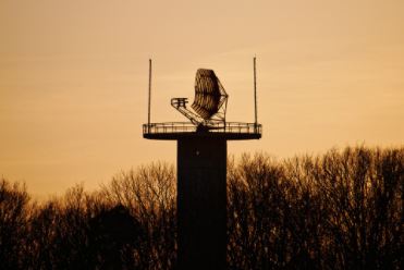
Conventional air defense systems are based on very long range radars, associated with batteries of ground-to-air missiles, spread in the territory. The closest missile battery to the detected air target will launch the missile, thanks to the 3D location provided by the radar.
However, radar solutions have their weaknesses:
As they emit electromagnetic waves, they can be easily detected and geolocated by the enemy who can then schedule precisely a massive attack of all radars stations with missiles.
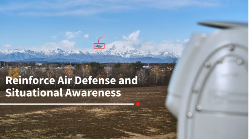
▶The SPYNEL backup solution for uninterrupted sky monitoring
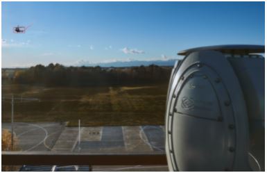
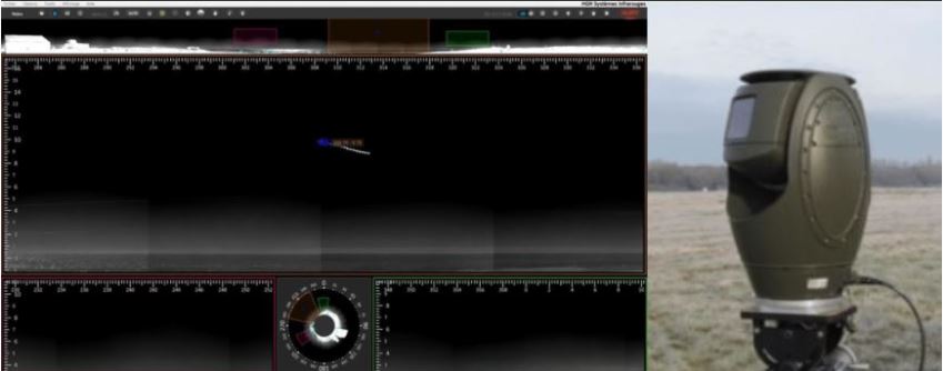
In case of radar destruction or malfunction of the communication lines, the overall Air Defense System is “blind” and becomes inoffensive although missiles launchers still operational. SPYNEL thermal panoramic detection and tracking solutions can then be urgently deployed in a few minutes, meeting the needs presented by high mobility deployments and silent operations.
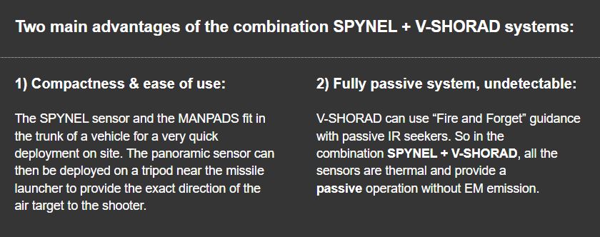
The SPYNEL passive sensors ensure real-time aerial situational awareness without being detected by the enemy. A SPYNEL-X 3500 sensor and its CYCLOPE video analytics software provide automatic detection, tracking and classification ranges of air targets compatible with the shooting ranges of Very Short Range Air Defence (V-SHORAD) missile launchers. The SPYNEL solution can be associated to a quickly deployed Man Portable Air Defence System (MANPADS) or to a more complex motorized missile station mounted on a vehicle or even on a ship.
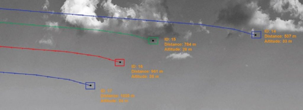
With CYCLOPE Software‘s Triangulation Plugin, the exact distance and altitude of each target is automatically calculated.
Two SPYNEL sensors are required, and installed at a short distance from each other, to get the 3D location (GPS/altitude) of multiple targets in a fully passive mode. This creates a “protective bubble” around a very wide area, and provides the V-SHORAD with very accurate information on the targets: