

SPYNEL-M CAMÉRA PANORAMIQUE INFRAROUGE COMPACTE ET MOBILE
SPYNEL-M est une caméra thermique panoramique compacte pour la sécurité périmétrique.
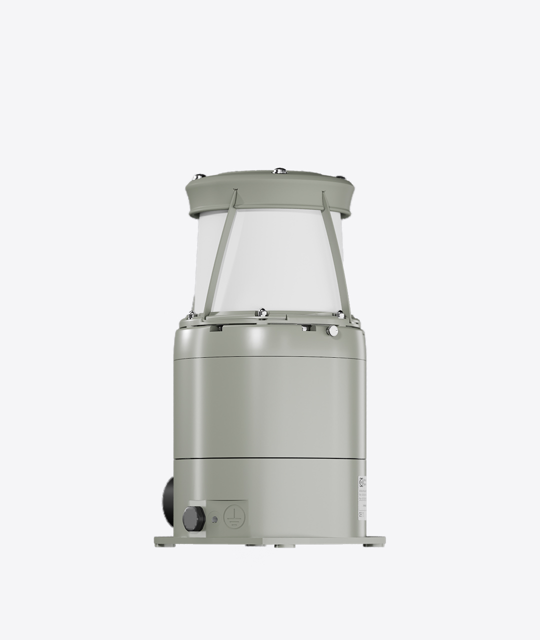
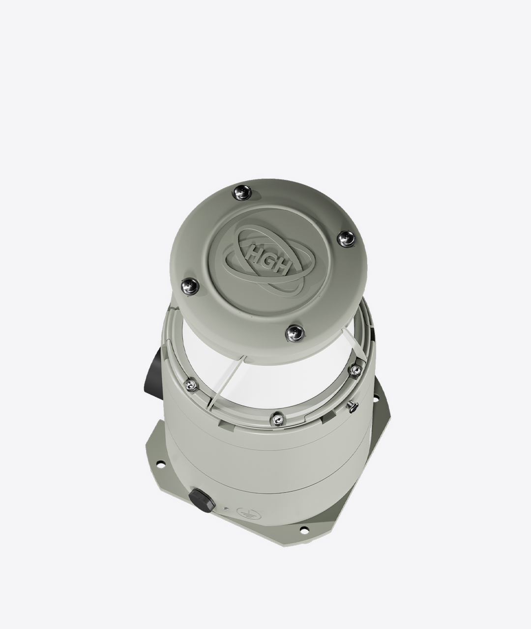
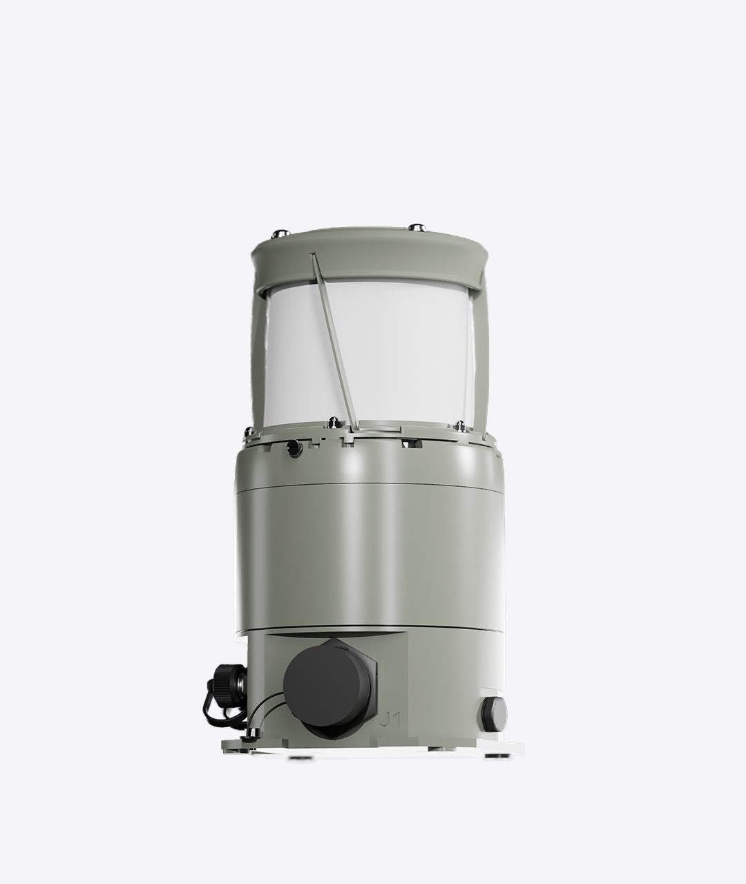
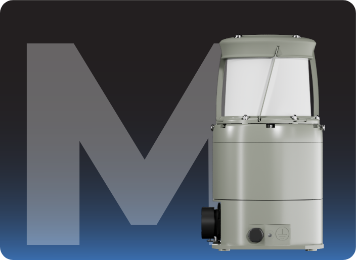
SPYNEL-M est une solution compacte et robuste pour la surveillance de grandes zones. Particulièrement compacte (1,8 kg et 12x20cm), SPYNEL-M est une caméra thermique panoramique haute résolution qui agit comme un radar infrarouge. La caméra capture en continu des images infrarouges complètes à 360 degrés, actualisées toutes les secondes, offrant une sécurité en temps réel contre les intrusions et les menaces de toutes sortes (personnes, RHIB, véhicules, etc.).
SPYNEL-M est facilement transportable : la caméra tient dans un sac à dos et peut être déployée très rapidement. La caméra thermique SPYNEL-M a été conçue pour être déployée en quelques minutes partout : du haut d’un bâtiment, sur un mât, en forêt… . La caméra infrarouge panoramique ne nécessite que 5 watts d’énergie. SPYNEL-M fonctionne avec des systèmes d’alimentation solaire/alternatif. Il assure un haut niveau d’autonomie, en particulier dans les opérations spéciales. SPYNEL-M est totalement passif et indétectable.
PRINCIPAUX AVANTAGES
CAPTEUR INFRAROUGE (IR)
> 600 pixels
SURVEILLANCE DE JOUR ET DE NUIT
Images panoramiques thermiques précises
IMAGES DE HAUTE PRÉCISION
Composants de haute définition et de haute qualité
INDÉTECTABLE ET INDÉCHIFFRABLE
Caméra entièrement passive, sans rayonnement électromagnétique
VUE PANORAMIQUE
Surveillance à 360° en temps réel
DETECTION DE TOUTES LES MENACES
Homme, véhicule, navire, RHIB, attaques simultanées
WHISTANDS EXTREME CONDITIONS
Chaleur, froid, vent, pluie, sable, obscurité totale
MOBILE
Facile à transporter et à déployer
GAMME DE PRODUITS

SPYNEL-M 600 W
Portée de détection
Humain : jusqu’à 400 m
Véhicule : jusqu’à 900 m
RHIB : jusqu’à 900 m
Distance de reconnaissance
Humain : jusqu’à 125 m
Véhicule : jusqu’à 250 m
RHIB : jusqu’à 250 m
Inclinaison verticale réglable
-18° / +18°
Champ de vision horizontal
360°
Champ de vision vertical
35,5° (-24° à +11,5° par défaut)
Taux de balayage 360°
1 Hz (360° / sec)
Résolution d’image
2,6 M pixels
Taux de balayage sectoriel
1,5 Hz sur un secteur de 180 degrés
2,5 Hz sur un secteur de 90 degrés
SPYNEL-M 600N
Portée de détection
Humain : jusqu’à 700 m
Véhicule : jusqu’à 1,5 km
RHIB : jusqu’à 1,5 km
Distance de reconnaissance
Humain : jusqu’à 250 m
Véhicule : jusqu’à 500 m
RHIB : jusqu’à 500 m
Inclinaison verticale réglable
-18° / +18°
Champ de vision horizontal
360°
Champ de vision vertical
18° (-15° à +3° par défaut)
Taux de balayage 360°
0,5 Hz (360° / 2sec)
Résolution de l’image
5,2 millions de pixels
Taux de balayage sectoriel
0,8 Hz sur un secteur de 180 degrés
1,5 Hz sur un secteur de 90 degrés
Performances de détection des caméras 360°
Plage de détection humaine
Gamme de reconnaissance des véhicules / RHIB
Portée de détection des humains
Portée de détection des véhicules / RHIB
- *Jusqu'à
- Portée de détection selon le critère de Johnson et les normes STANAG.
- Les valeurs de portée représentent les performances optimales, qui varient en fonction de la taille de la cible, de l'encombrement, des conditions atmosphériques et des paramètres opérationnels du capteur
- Les informations ci-dessus peuvent être modifiées sans préavis
DETECTION PANORAMIQUE A 360°
Le SPYNEL-M permet de réduire le délai entre la détection de la cible et les contre-mesures. Le SPYNEL-M intègre une caméra infrarouge (IR) haute résolution permettant une classification précise de la cible. La caméra thermique Spynel détecte et reconnaît un nombre illimité de pistes, affichant des images hautes résolutions. Le capteur thermique peut facilement suivre des menaces, comme des petites cibles, lentes ou en mouvement. La caméra infrarouge SPYNEL-M peut être utilisée comme solution autonome de sécurité périmétrique ou combinée à des systèmes existants.
Spécifications techniques
(-24° à +11,5° par défaut)
Spécifications techniques
CAPTEUR FPA LWIR NON REFROIDI
> (≥600 pixels horizontalement)
RESOLUTION DE L'IMAGE
5.2 Mpixels
SURVEILLANCE PANORAMIQUE
Taux de balayage à 360° jusqu’à 0.5 Hz (360°/2sec)
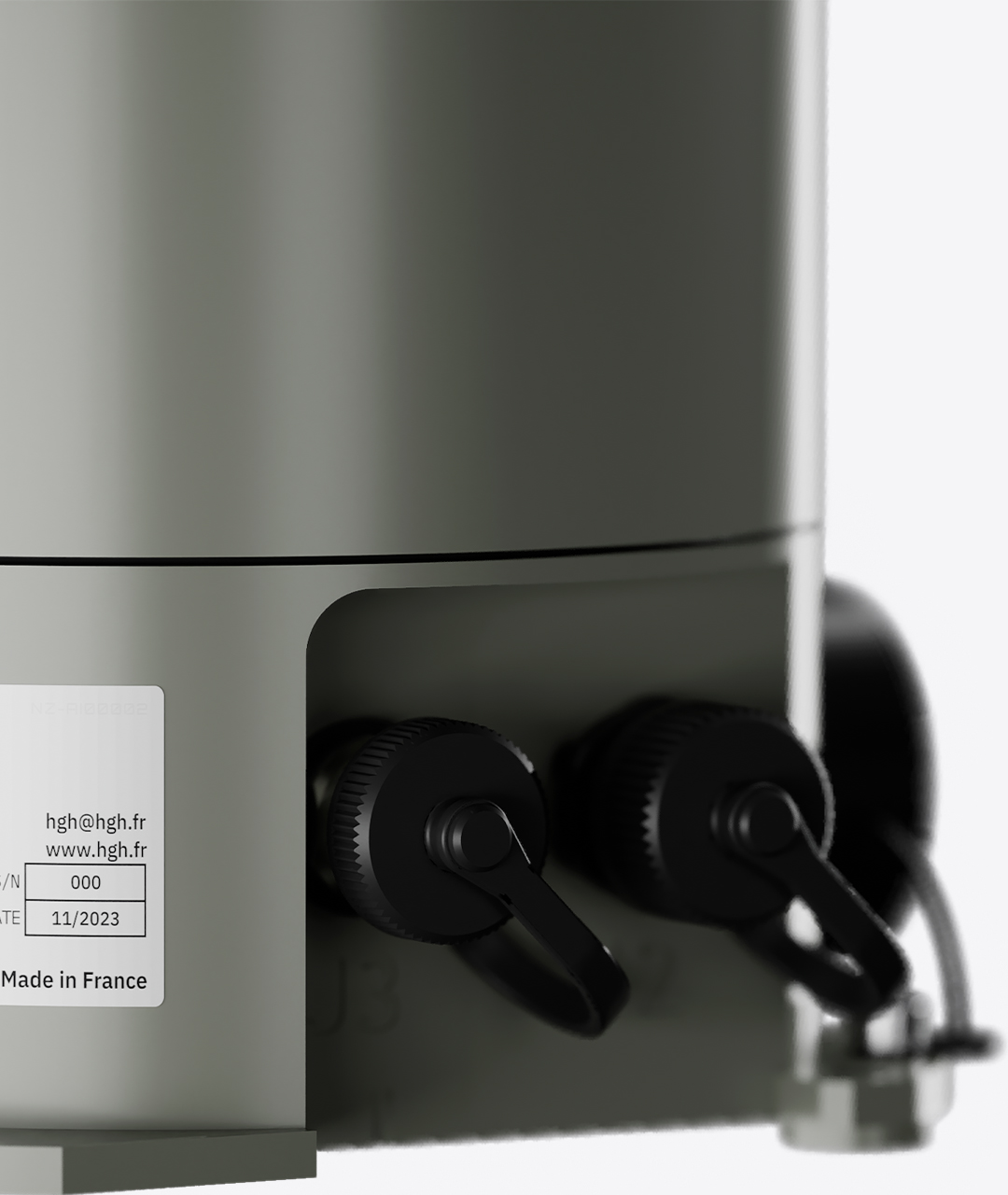
DIMENSIONS/POIDS
Poids : 1.8 kg – Dimensions (Diamètre x Hauteur): 125 mm x 200 mm
SPÉCIFICATIONS VERTICALES ET HORIZONTALES
(-24° à +11,5° par défaut)
CAPACITE D'INTEGRATION
H264, XML, MIME, TCP/IP, Client/Serveur
CONCEPTION POUR CONDITIONS EXTREMES
Température : de -40°C à+71°C – Intégralement étanche
La caméra thermique 360° Spynel-M fournit des images panoramiques en temps réel avec une détection automatique des intrusions et des capacités de suivi précises. Spynel-M est entièrement passif (indétectable) et non brouillable. Le capteur infrarouge fonctionne 24 heures sur 24, 7 jours sur 7, par beau ou mauvais temps.
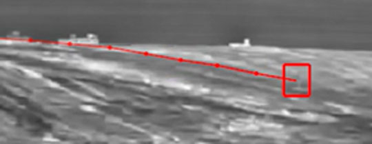
Soutenue par le logiciel exclusif de détection avancée des menaces Cyclope de HGH, la caméra infrarouge (IR) à 360° du SPYNEL-M permet une discrimination précoce des cibles, de jour comme de nuit. Elle peut détecter et identifier simultanément un nombre illimité de pistes. Aucune exception n’est faite pour les menaces difficilement détectables comme les nageurs, les semi-rigides, les cibles aériennes à basse altitude, les drones ou les avions furtifs.
SPYNEL-M est une solution indispensable pour la surveillance de zones étendues, notamment la surveillance d’aéroports et d’aérodromes, la surveillance de ports, la sécurité d’installations pétrolières et gazières terrestres, la protection de plates-formes pétrolières et gazières offshore, la protection de bases militaires aériennes, navales, de bases d’opérations avancées, la protection d’infrastructures critiques, la surveillance de zones maritimes étendues, la détection d’incendies.
| SPYNEL-M 600N | SPYNEL-M 600W | |
|---|---|---|
| Horizontal FOV | 360° | 360° |
| Vertical FOV | 35.5° (-24° to +11.5° by default) | 18° (-15° to +3° by default) |
| Scanning rate | 1 Hz (360° / sec) | 0.5 Hz (360° / 2sec) |
| Detector type | Uncooled LWIR FPA (≥600 pixels horizontally) | Uncooled LWIR FPA (≥600 pixels horizontally) |
| Human Detection Range | Up to 0.4 km | Up to 0.7 km |
| Vehicle Detection Range | Up to 0.9 km | Up to 1.5 km |
| RHIB Detection Range | Up to 0.9 km | Up to 1.5 km |
Portée de détection selon le critère de Johnson et les normes STANAG.
![]()
> Télécharger la documentation cyclope
> Vidéo Cyclope
Principaux avantages de Cyclope
- Traitement des signaux basé sur 15 ans d’expérience pour toutes les applications
- Un seul logiciel de base pour garantir la fiabilité et la robustesse
- Unité de traitement Cyclope Server tout-en-un (matériel et logiciel)
- Ensemble supplémentaire de Plugins, logiciel additionnels
Cyclope : caractéristiques principales
- Détection et classification automatiques
- Suivi automatique
- Toutes les cibles terrestres, aériennes et maritimes sont détectée
- Configuration manuelle ou automatique des paramètres de détection (pas de réglage par l’opérateur)
- Détection 3D
- Définition de zones personnalisées
- Définition de menaces personnalisées
- Fonction de détection de franchissement de ligne
- Éditeur de gestion des alarmes
- Visualisation et suivi automatique des nouvelles menaces
Algorithmes spécifiques
- Algorithme d’apprentissage de l’IA pour la classification automatique des menaces
- Capacités de détection du ciel dans un environnement encombré
- Détection spécifique des incendies
- Détection de mouvement à longue portée (toutes les cibles et tous les contrastes thermiques sont pris en charge)
Éditeur d’alarmes, définition d’alarmes personnalisées par:
- Classe
- Zone
- Dimension
- Tendance
- Intensité
- Vitesse
- Direction
Actions spécifiques d’alarmes automatiques:
- Enregistrement
- XML
- Marque-page spécifique…
Analyse
- Repères d’intrusion
- Manuel
- Automatique
- Post-analyse
- Fonction timeshift facile (replay)
- Enregistrement à 360°
- Détection de la position géographiques des cibles
- Cartographie instantanée des intrusions
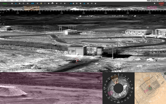
Interface Cyclope
Détection et suivi
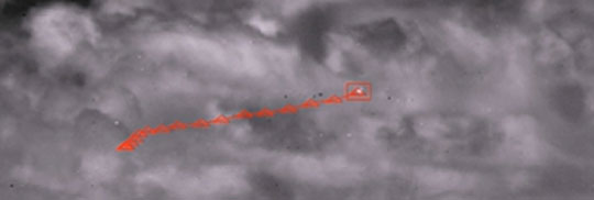
Détection aérienne
Détection de mouvement
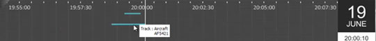
Mode play back
Fusion avec signal AIS
![]()
GAIA : classification automatique des menaces basée sur l’intelligence artificielle
Intégré aux solutions de surveillance longue distance SPYNEL, le tout nouveau traitement d’intelligence artificielle GAIA offre des capacités uniques sur le marché en termes de classification automatique d’objets dans les images thermiques panoramiques. Le module d’intelligence artificielle utilise trois réseaux neuronaux en instance de brevet, conçus pour reconnaître des modèles pour les applications de surveillance maritime, terrestre et aérienne. La classification automatique est opérationnelle à longue distance, sur une très large gamme de cibles terrestres et maritimes, de quelques pixels seulement à des objets de très grande taille.
La combinaison unique de l’intelligence artificielle GAIA et de l’analyse vidéo Cyclope permet une détection, un suivi et une classification avancés de tous les types de menaces. L’utilisation de l’intelligence artificielle réduit considérablement le taux de fausses alarmes pour les applications de surveillance de zones étendues, améliore l’efficacité des décisions humaines et réduit l’utilisation des moyens opérationnels.
De la détection à la classification : les 4 étapes du processus GAIA

Les principaux avantages de l’intelligence artificielle
- Le taux de fausses alarmes est fortement réduit
- Paramètres personnalisés faciles et rapides à définir
- Information en temps réel
- Amélioration de la fiabilité
- Faciliter la décision humaine
- Réduit les coûts des ressources humaines (équipes de sécurité)
Caractéristiques principales de Gaïa
- Détection et classification dès la première apparition à l’image des menaces et sans latence
- Prise en charge de tous les types de taille de menace : de quelques pixels à de très gros objets
- Détection à toute distance : courte, moyenne et longue portée
- Détection d’objets fixes et/ou mobiles
- Confirmations d’alarme :
- Objets en mouvement très rapide
- Courte portée
- Visibilité discontinue due à des obstacles (végétation, arbres…)
- Très faible taux de fausses alarmes dans des conditions complexes :
- Végétation en mouvement,
- Animaux,
- Etat de la mer agité,
- Les reflets du soleil…
- Amélioration de l’évaluation de la portée des cibles
- Multiples classes disponibles : humain, véhicule, bouée, semi-rigide, voilier…
- Capacité de détecter des personnes dans n’importe quelle position et/ou des objets partiellement cachés
- Algorithme évolutif et personnalisable :
- Nouvelles classes (requises pour une application client spécifique)
- Optimisation de l’algorithme
Module de gestion des alarmes
Classification automatique des menaces en fonction de multiples conditions (classification GAIA, dimensions, tendance, intensité, vitesse, trajectoire, classe de cible, taille, franchissement de la clôture virtuelle, distance…)
Alarmes automatiques déclenchant des actions spécifiques (enregistrement, courriel, XML, signet spécifique…)
L’intelligence artificielle de GAIA est renforcée par la bibliothèque de traitement d’image I2Q qui permet d’obtenir une qualité d’image jour/nuit supérieure quelles que soient les conditions environnementales. Le traitement d’image I2Q comprend de nombreux algorithmes destinés à améliorer l’expérience de l’utilisateur, tels que la réduction des reflets du soleil, le débruitage intelligent, l’amélioration du contraste local de l’image et bien d’autres encore.
Bibliothèque I²QTM pour l’amélioration intelligente des images
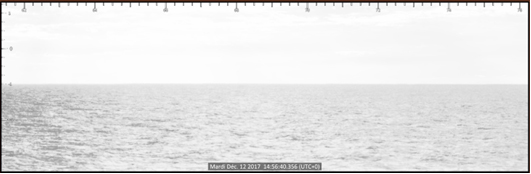
Image originale
(zones saturées dans le panorama)
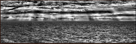
Amélioration de la qualité I²Q
(pas de saturation sur 360°)
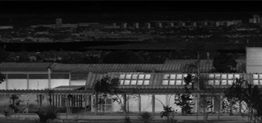
Image originale
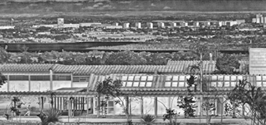
Après prétraitement terrestre I²Q
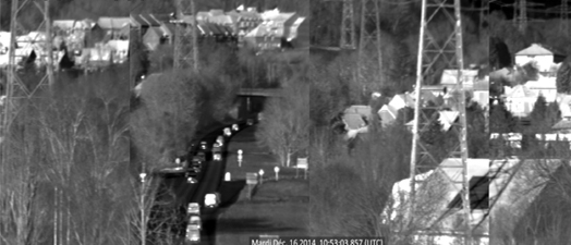
Image originale
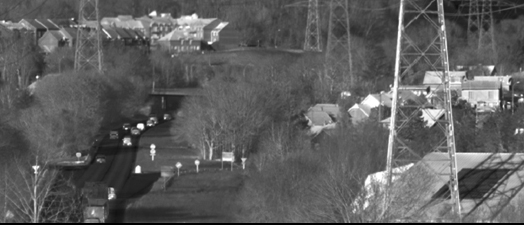
Après correction de distorsion I²Q
(Assemblage d’images – correction de la distorsion)
Applications
A DECOUVRIR

References
