


SPYNEL
CAMÉRA PANORAMIQUE DE DÉFENSE ET DE SÉCURITÉ
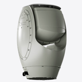
SPYNEL est une caméra panoramique 360° avec la plus haute définition du marché.
Ce système IRST (InfraRed Search & Track system) est conçu pour répondre aux besoins de surveillance militaire et civile.
Le système de surveillance passive de zones étendues Spynel-S assure une sécurité en temps réel contre les menaces conventionnelles et asymétriques. Grâce au logiciel CYCLOPE, la solution Spynel-S assure une détection automatique, un suivi précis et une classification exacte. SPYNEL-S intègre un capteur infrarouge à ondes moyennes (MWIR) pour capturer jusqu’à 30 Mpix de flux vidéo de jour et de nuit (matrice de plans focaux 640 x 512).
SPYNEL
Principaux avantages
SURVEILLANCE JOUR ET NUIT
Caméra équipée du dernier capteur infrarouge
VUE PANORAMIQUE
Surveillance à 360° en temps réel
INDETECTABLE
Caméra entièrement passive, sans rayonnement électromagnétique
TOUTES LES MENACES SONT DÉTECTÉES ET CLASSÉES
Humain, véhicule, navire, UAV, RHIB, attaques simultanées
SURVEILLANCE DE ZONES ÉTENDUES
Portée de détection des véhicules jusqu’à 10 KM
IMAGES HAUTE RÉSOLUTION
Composants de haute définition et de haute qualité
FACILE À DÉPLOYER
Intégration rapide dans les systèmes de sécurité existants
Résiste aux conditions extrêmes
Chaleur, froid, vent, pluie, sable, obscurité totale
SPYNEL
Gamme de produits
SPYNEL-S 2000
Portée de détection
Humain : jusqu’à 1,5 km
Véhicule : jusqu’à 3,5 km
RHIB : jusqu’à 3,5 km
Distance de reconnaissance
Humain : jusqu’à 500 m
Véhicule : jusqu’à 1,2 km
RHIB : jusqu’à 1,2 km
Champ de vision horizontal
360°
Champ de vision vertical
20°
Champ de vision instantané (IFOV)
0,6 x 0,6 mrad x mrad
Vitesse de balayage 360°
2 rps (360°/0.5sec)
Résolution de l’image
11 500 (H) x 640 (V)
Détecteur infrarouge
Infrarouge à ondes moyennes (MWIR) 640×512 FPA
SPYNEL-S 6000
Portée de détection
Humain : jusqu’à 6 km
Véhicule : jusqu’à 10 km
RHIB : jusqu’à 10 km
Distance de reconnaissance
Humain : jusqu’à 2 km
Véhicule : jusqu’à 4 km
RHIB : jusqu’à 4 km
Champ de vision horizontal
360°
Champ de vision vertical
5°
Champ de vision instantané (IFOV)
0,15 x 0,15 mrad x mrad
Vitesse de balayage à 360°
0,5 rps (360°/ 2sec)
Résolution de l’image
46 000 (H) x 640 (V)
Détecteur infrarouge
Infrarouge à ondes moyennes (MWIR) 640×512 FPA
SPYNEL
Performances de détection de la caméra infrarouge 360°
Plage de détection humaine
Portée de détection des véhicules / RHIB
Plage de reconnaissance humaine
Gamme de reconnaissance des véhicules / RHIB
-
-
- *Jusqu'à
- Portée de détection selon le critère de Johnson et les normes STANAG.
- Les valeurs de portée représentent les performances optimales, qui varient en fonction de la taille de la cible, de l'encombrement, des conditions atmosphériques et des paramètres opérationnels du capteur
- Les informations ci-dessus peuvent être modifiées sans préavis
-
DETECTION 360° PANORAMIQUE
Les caméras SPYNEL sont des solutions de surveillance de zones étendues de haute qualité. La caméra acquiert en temps réel des images thermiques panoramiques. La détection, le suivi et la classification automatiques sont assurés par le logiciel CYCLOPE. La caméra SPYNEL-S intègre un plan focal mégapixel dans l’infrarouge moyenne onde (MWIR) et un capteur IRST (InfraRed Search&Track) avec la plus haute résolution du marché.
Sécurité périmétrique : caméra de surveillance panoramique à longue distance
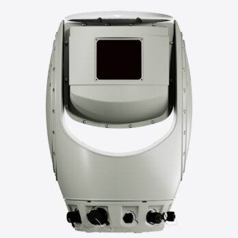
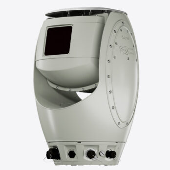
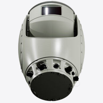
Disponible en version terrestre et maritime, Spynel-S® peut résister à des conditions météorologiques et à des températures extrêmes. Il peut être utilisé comme solution de sécurité périmétrique autonome, fiable et rentable. La solution de caméra infrarouge Spynel sécurise l’ensemble d’une installation grâce à ses capacités de détection d’intrusions multiples et de suivi sur 360°.
SPYNEL
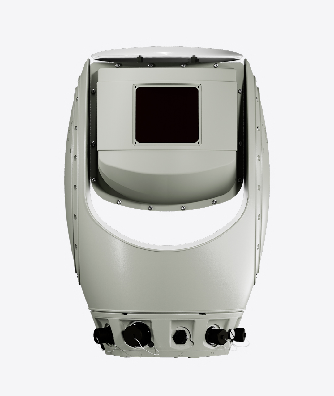
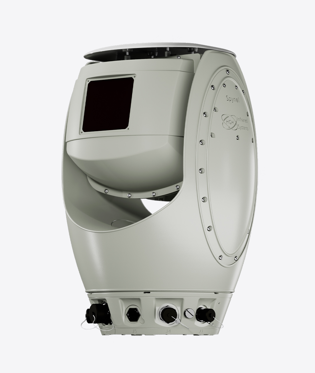
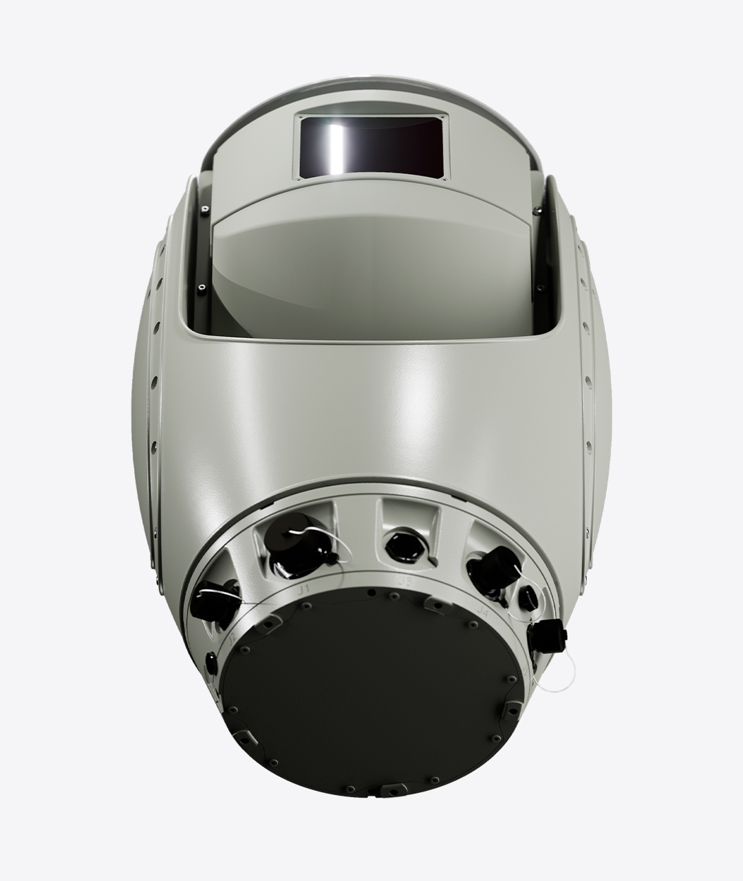
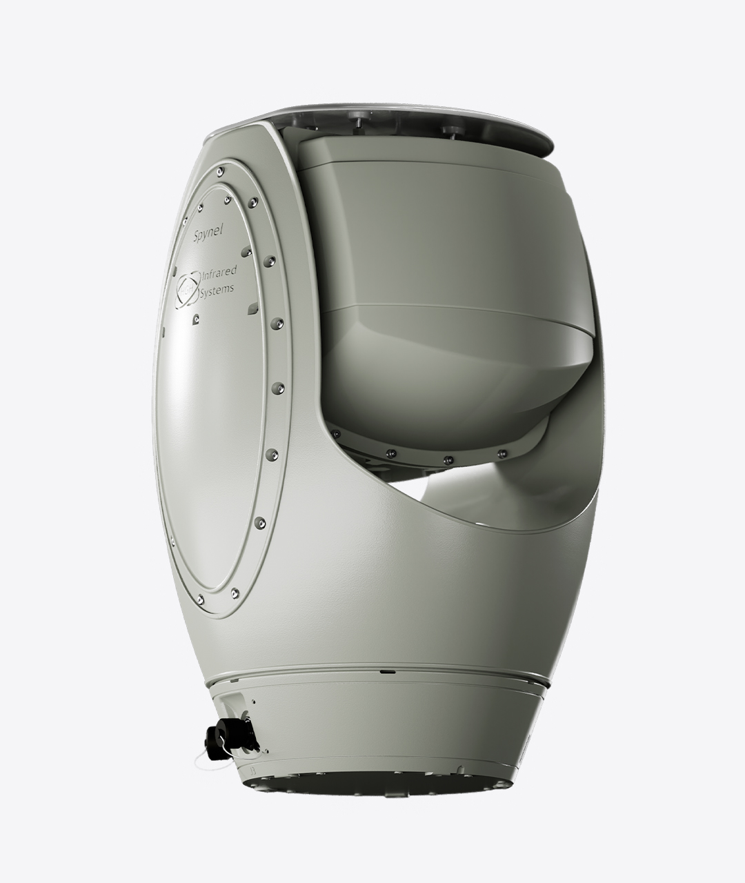
Spécifications techniques
Spynel-S est un système de surveillance panoramique, à longue portée, conçu pour détecter, classifier et suivre automatiquement tout type de menace, de nuit comme de jour.
Tournant continuellement à une vitesse pouvant atteindre 2 tours par seconde, Spynel-S offre une excellente connaissance de la situation grâce à une visualisation à 360 degrés de l’environnement. En tant que capteur thermique entièrement passif, il est invisible pour les intrus et n’est pas vulnérable au camouflage ni au brouillage, contrairement aux technologies radar. Doté d’un grand plan focal infrarouge à ondes moyennes (MWIR), Spynel-S affiche de hautes performances, capturant un flux vidéo de 30 millions de pixels.
Équipé de notre Cyclope, logiciel avancé de détection des menaces, le capteur infrarouge (IR) à 360° permet une discrimination précoce des cibles sur des zones extrêmement étendues, de nuit comme de jour, quelles que soient les conditions météorologiques. Un nombre illimité de pistes sont détectées et identifiées simultanément. Aucune exception n’est faite pour les menaces difficilement détectables comme les nageurs, les semi-rigides, les cibles aériennes à basse altitude, les drones ou les avions furtifs.
SPYNEL-S est une solution incontournable pour la surveillance de zones étendues, la sécurisation continue de périmètres et la protection d’infrastructures critiques, mais aussi pour des applications militaires telles que la protection de bases d’opérations avancées (FOB) ou l’autoprotection de navires.
| SPYNEL-S 2000 | SPYNEL-S 6000 | |
|---|---|---|
| Horizontal FOV | 360° | 360° |
| Vertical FOV | 20° | 5° |
| Vertical motorized tilt | ± 45° (motorized) | ± 45° (motorized) |
| IFOV | 0.6 x 0.6 mrad x mrad | 0.15 x 0.15 mrad x mrad |
| Scanning speed | 2 rps (360°/0.5sec) | 0.5 rps (360°/ 2sec) |
| Detector type | MWIR 640x512 FPA | MWIR 640x512 FPA |
| Cooling | Stirling microcooler | Stirling microcooler |
| Image resolution | 11 500 (H) x 640 (V) | 46 000 (H) x 640 (V) |
| Video output and control | IP | IP |
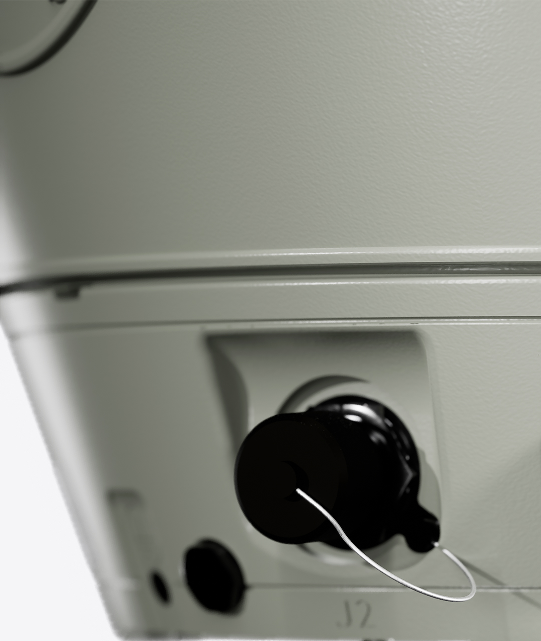
| Dimensions (Dia x H) | 385 mm x 580 mm | 385 mm x 580 mm |
| Weight | < 40 kg | < 40 kg |
| Operating temperature | -40°C to +71°C | -40°C to +71°C |
| Protection standard | IP 66 | IP 66 |
| Power supply | 24V DC / 10 Amps | 24V DC / 10 Amps |
| Detection range for Human: Vehicle: RHIB: | Up to 1.5 km Up to 3.5 km Up to 3.5 km | Up to 6 km Up to 10 km Up to 10 km |
Les plages de détection selon le critère de Johnson et les normes STANAG
![]() CYCLOPE est le logiciel de détection automatique d’intrusion, de classification et de suivi qui analyse le flux vidéo haute résolution à 360 degrés capturé par la caméra SPYNEL.
CYCLOPE est le logiciel de détection automatique d’intrusion, de classification et de suivi qui analyse le flux vidéo haute résolution à 360 degrés capturé par la caméra SPYNEL.
> Télécharger la brochure Cyclope
> Cyclope video
Principaux avantages de Cyclope
- Traitement des signaux basé sur 15 ans d’expérience pour toutes les applications
- Un seul logiciel de base pour garantir la fiabilité et la robustesse
- Unité de traitement Cyclope Server tout-en-un (matériel et logiciel)
- Plugins logiciel additionnels
Cyclope : caractéristiques principales
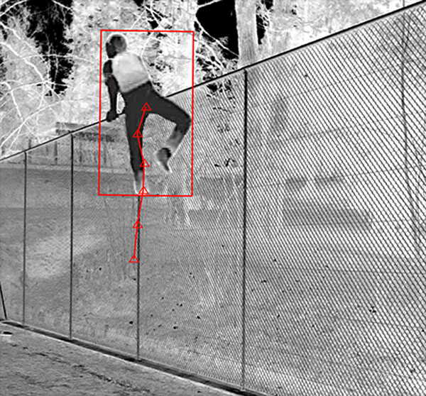
- Détection et classification automatiques
- Suivi automatique
- Toutes les cibles terrestres, aériennes et maritimes sont détectées
- Configuration manuelle ou automatique des paramètres de détection (pas de réglage par l’opérateur)
- Détection 3D
- Définition de zones personnalisées
- Définition de menaces personnalisées
- Fonction de détection de franchissement de ligne
- Éditeur de gestion des alarmes
- Visualisation et suivi automatique des nouvelles menaces
Algorithmes spécifiques
- Algorithme d’apprentissage de l’IA pour la classification automatique des menaces
- Capacités de détection du ciel dans un environnement encombré
- Détection spécifique des incendies
- Détection de mouvement à longue portée (toutes les cibles et tous les contrastes thermiques sont pris en charge)
Éditeur d’alarmes, définition d’alarmes personnalisées par:
- Classe
- Zone
- Dimension
- Tendance
- Intensité
- Vitesse
- Direction
Actions spécifiques d’alarmes automatiques:
- Enregistrement
- XML
- Marque-page spécifique…
Analyse
- Repères d’intrusion
- Manuel
- Automatique
- Post-analyse
- Fonction timeshift facile (replay)
- Enregistrement à 360°
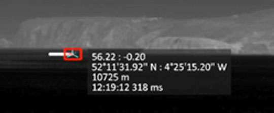
- Détection de la position géographiques des cibles
- Cartographie instantanée des intrusions
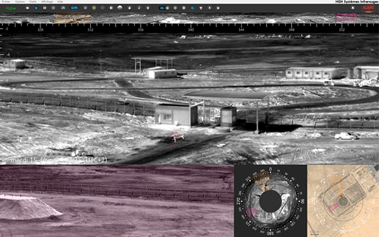
Interface Cyclope
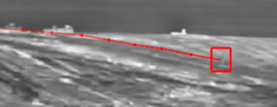
Détection et suivi
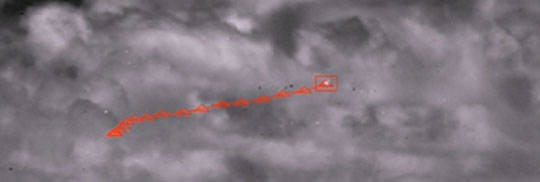
Détection aérienne
Détection de mouvement
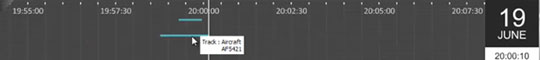
Mode play back
Fusion avec signal AIS
![]()
GAIA : classification automatique des menaces basée sur l’intelligence artificielle
Intégré aux solutions de surveillance longue distance SPYNEL, le tout nouveau traitement d’intelligence artificielle GAIA offre des capacités uniques sur le marché en termes de classification automatique d’objets dans les images thermiques panoramiques. Le module d’intelligence artificielle utilise trois réseaux neuronaux en instance de brevet, conçus pour reconnaître des modèles pour les applications de surveillance maritime, terrestre et aérienne. La classification automatique est opérationnelle à longue distance, sur une très large gamme de cibles terrestres et maritimes, de quelques pixels seulement à des objets de très grande taille.
La combinaison unique de l’intelligence artificielle GAIA et de l’analyse vidéo Cyclope permet une détection, un suivi et une classification avancés de tous les types de menaces. L’utilisation de l’intelligence artificielle réduit considérablement le taux de fausses alarmes pour les applications de surveillance de zones étendues, améliore l’efficacité des décisions humaines et réduit l’utilisation des moyens opérationnels.

Les principaux avantages de l’intelligence artificielle
- Le taux de fausses alarmes est fortement réduit
- Paramètres personnalisés faciles et rapides à définir
- Information en temps réel
- Amélioration de la fiabilité
- Faciliter la décision humaine
- Réduit les coûts des ressources humaines (équipes de sécurité)
Caractéristiques principales de Gaïa
- Détection et classification dès la première apparition à l’image des menaces et sans latence
- Prise en charge de tous les types de taille de menace : de quelques pixels à de très gros objets
- Détection à toute distance : courte, moyenne et longue portée
- Détection d’objets fixes et/ou mobiles
- Confirmations d’alarme :
- Objets en mouvement très rapide
- Courte portée
- Visibilité discontinue due à des obstacles (végétation, arbres…)
- Très faible taux de fausses alarmes dans des conditions complexes :
- Végétation en mouvement,
- Animaux,
- Etat de la mer agité,
- Les reflets du soleil…
- Amélioration de l’évaluation de la portée des cibles
- Multiples classes disponibles : humain, véhicule, bouée, semi-rigide, voilier…
- Capacité de détecter des personnes dans n’importe quelle position et/ou des objets partiellement cachés
- Algorithme évolutif et personnalisable :
- Nouvelles classes (requises pour une application client spécifique)
- Optimisation de l’algorithme
Module de gestion des alarmes
Classification automatique des menaces en fonction de multiples conditions (classification GAIA, dimensions, tendance, intensité, vitesse, trajectoire, classe de cible, taille, franchissement de la clôture virtuelle, distance…)
Alarmes automatiques déclenchant des actions spécifiques (enregistrement, courriel, XML, signet spécifique…)
L’intelligence artificielle de GAIA est renforcée par la bibliothèque de traitement d’image I2Q qui permet d’obtenir une qualité d’image jour/nuit supérieure quelles que soient les conditions environnementales. Le traitement d’image I2Q comprend de nombreux algorithmes destinés à améliorer l’expérience de l’utilisateur, tels que la réduction des reflets du soleil, le débruitage intelligent, l’amélioration du contraste local de l’image et bien d’autres encore.
Bibliothèque I²QTM pour l’amélioration intelligente des images
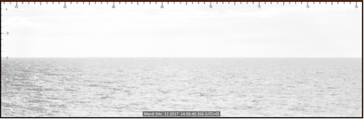
Image originale
(zones saturées dans le panorama)
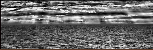
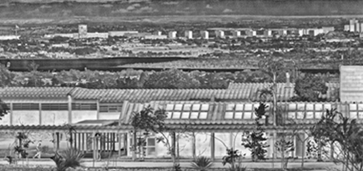
Amélioration de la qualité I²Q
(pas de saturation sur 360°)
I²Q
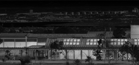
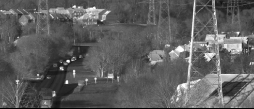
Image originale
Après prétraitement terrestre I²Q
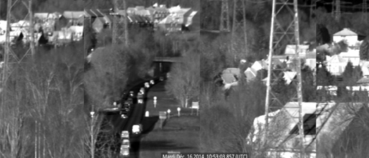
Image originale
Après correction de distorsion I²Q
(Assemblage d’images – correction de la distorsion)
