


SPYNEL
COMPACT AND MOBILE INFRARED PANORAMIC CAMERA
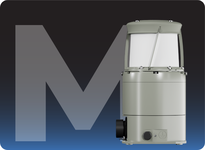
SPYNEL-M is a compact panoramic thermal camera for perimeter security.
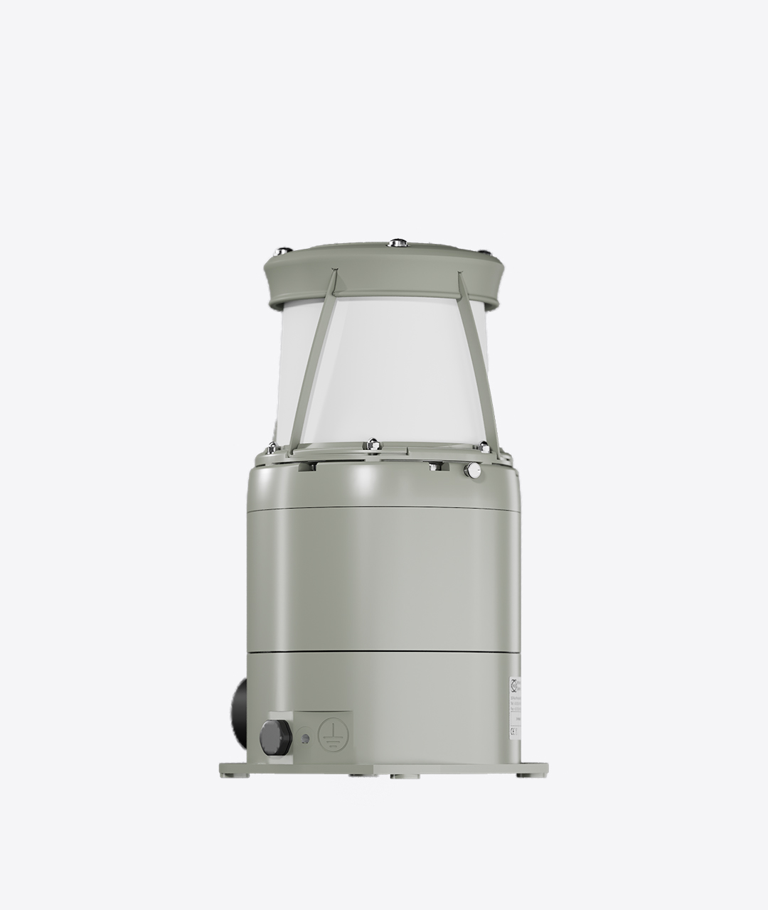
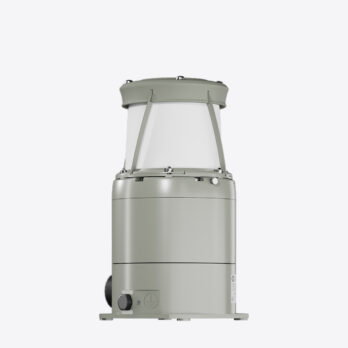
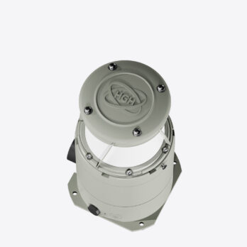
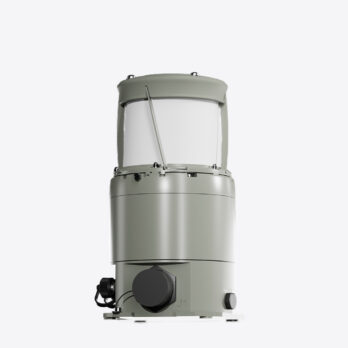
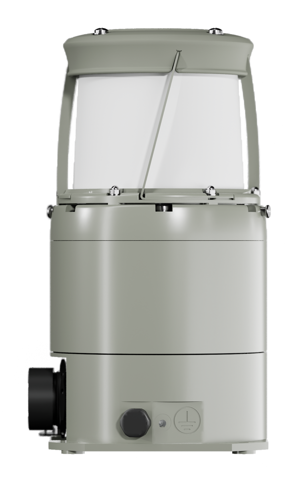
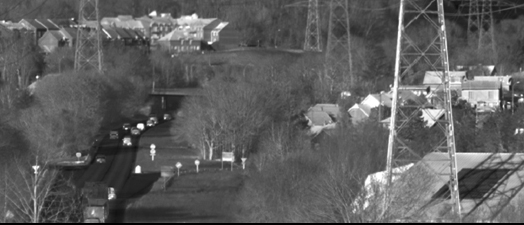
SPYNEL-M is a compact and robust solution for monitoring large areas. Particularly compact (1.8 kg and 12x20cm), SPYNEL-M is a high-resolution panoramic thermal camera that acts like an infrared radar. The camera continuously captures full 360-degree infrared images, updated every second, providing real-time security against intrusions and threats of all kinds (people, RHIBs, vehicles, etc.)
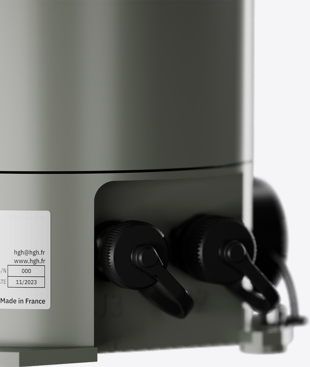
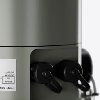
SPYNEL-M is easily transportable: the camera stands in a backpack and can be deployed very quickly. The SPYNEL-M thermal camera has been designed to be deployed in a few minutes everywhere: from the top of a building, on a mast, in the woods… . The panoramic infrared camera requires only 5 watts of power. SPYNEL-M works with solar/ alternate power supply systems. It ensures a high level of autonomy espacially in remote operations. SPYNEL-M is fully autonomous meaning that the camera does not need any additional light source. SPYNEL-M is fully passive and undetectable (unjammable).
SPYNEL
Main benefits
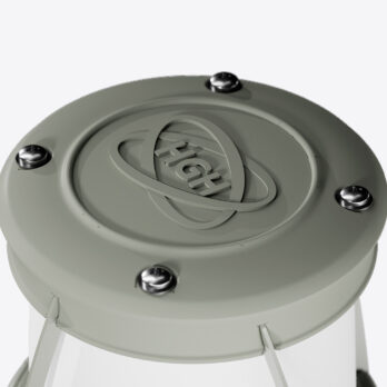
INFRARED (IR) SENSOR
> 600 pixels
DAY AND NIGHT SURVEILLANCE
Precise thermal panoramic images
HIGH ACCURACY IMAGES
High definition, high quality components
UNDETECTABLE AND UNJAMMABLE
Fully passive camera, no electromagnetic radiation
PANORAMIC VIEW
360° surveillance in real-time
ALL THREATS DETECTED
Human, vehicle, ship, RHIB, simultaneous attacks
withstands extreme conditions
Heat, cold, wind, rain, sand, full darkness
MOBILE
Easy to carry and to deploy
SPYNEL
Product range
SPYNEL-M 600 W
Detection range
Human: up to 400 m
Vehicle: up to 900 m
RHIB: up to 900 m
Recognition range
Human: up to 125 m
Vehicle: up to 250 m
RHIB: up to 250 m
Vertical adjustable tilt
-18° / +18°
Horizontal field of view
360°
Vertical field of view
35.5° (-24° to +11.5° by default)
360° scanning rate
1 Hz (360° / sec)
Image resolution
2.6 M pixels
Sector scan rate
1.5 Hz on 180-degree sector
2.5 Hz on 90-degree sector
SPYNEL-M 600 N
Detection range
Human: up to 700 m
Vehicle: up to 1.5 km
RHIB: up to 1.5 km
Recognition range
Human: up to 250 m
Vehicle: up to 500 m
RHIB: up to 500 m
Vertical adjustable tilt
-18° / +18°
Horizontal field of view
360°
Vertical field of view
18° (-15° to +3° by default)
360° scanning rate
0.5 Hz (360° / 2sec)
Image resolution
5.2M pixels
Sector scan rate
0.8 Hz on 180-degree sector
1.5 Hz on 90-degree sector
SPYNEL
360° mobile infrared camera detection performances
Human Detection Range
Vehicle / RHIB Detection Range
Human Recognition Range
Vehicle / RHIB Recognition Range
- *Up to
- Detection range according to Johnson criterium and STANAG standards.
- Range values represent optimal performance, which will vary depending on target size, clutter environment, atmospheric conditions and sensor operational settings
- Above information is subject to changes without notice
REACT FAST THANKS TO EARLY TARGET DETECTION
Reduce the time between target detection and counter measures with the SPYNEL-M. The SPYNEL-M embeds a high resolution infrared (IR) camera allowing a precise target classification. Spynel thermal imaging camera detects & recognizes an unlimited number of tracks, displaying high resolution images. The thermal sensor hardly tracks detectable threats, like small, slow or tangential moving targets. The Infrared Camera SPYNEL-M can be used as a standalone perimeter security solution or combined with existing systems.
SPYNEL
Technical specifications
The 360° thermal camera Spynel-M provides real-time panoramic images with automatic intrusion detection and precise tracking capabilities. Spynel-M is fully passive (undetectable) and unjammable The infrared sensor operates in 24×7, in good or bad weather conditions
Backed with HGH’s exclusive Cyclope advanced threat detection software, the 360° Infrared (IR) camera of the SPYNEL-M allows early target discrimination at day and night. An unlimited number of tracks are simultaneously detected and identified. No exception is made for hardly detectable threats like swimmers, RIBs, low altitude air targets, UAVs or stealth aircrafts.
SPYNEL-M is a must-have solution for wide area surveillance including airport and airfield surveillance, harbour monitoring, Onshore oil & gas facility security, offshore oil & gas plateform protection, military base protection air, naval, forward operation base, critical infrastructure protection, maritime wide area surveillance, fire detection.
| SPYNEL-M 600N | SPYNEL-M 600W | |
|---|---|---|
| Horizontal FOV | 360° | 360° |
| Vertical FOV | 35.5° (-24° to +11.5° by default) | 18° (-15° to +3° by default) |
| Scanning rate | 1 Hz (360° / sec) | 0.5 Hz (360° / 2sec) |
| Detector type | Uncooled LWIR FPA (≥600 pixels horizontally) | Uncooled LWIR FPA (≥600 pixels horizontally) |
| Human Detection Range | Up to 0.4 km | Up to 0.7 km |
| Vehicle Detection Range | Up to 0.9 km | Up to 1.5 km |
| RHIB Detection Range | Up to 0.9 km | Up to 1.5 km |
Detection ranges according to Johnson criterium and STANAG standards
![]() CYCLOPE is the automatic intrusion detection, classification and tracking software analysing
CYCLOPE is the automatic intrusion detection, classification and tracking software analysing
the 360-degree high resolution video stream captured by the SPYNEL camera.
> Download Cyclope brochure
> Cyclope video
Cyclope main benefits
- Signal processing based on 15 years experience for all applications
- One single core software to ensure reliability and robustness
- All-In-One Cyclope Server processing unit (Hardware and Software)
- Additional set of plugins
Cyclope main features
- Automatic detection & classification
- Automatic tracking
- All ground, air and maritime targets detected
- Manual or automatic detection parameters setup (no operator adjustment)
- 3D detection
- Custom zones definition
- Custom threats definition
- Crossing line detection function
- Alarm management editor
- New threats automatic visualisation and tracking
Specific algorithms
- AI deep learning algorithm for automatic threat classification
- Sky detection capabilities in cluttered environment
- Specific fire detection
- Long range tracking motion detection (any targets and thermal contrasts supported)
Alarm Editor, custom alarm definition by:
- Class
- Zone
- Dimension
- Trend
- Intensity
- Speed
- Direction
Specific actions automatic alarms:
- Recording
- XML
- Specific bookmark…
Analysis
- Intrusion bookmarks
- Manual
- Automatic
- Post-analysis
- Easy timeshift function (replay)
- 360° recording
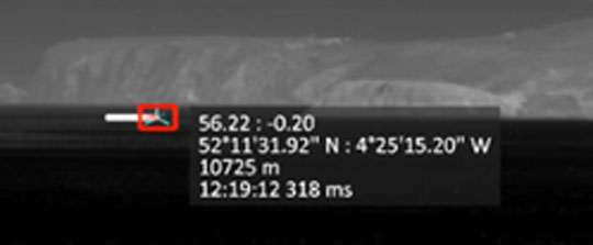
- Geographic targets position detection
- Intrusion instantaneous mapping
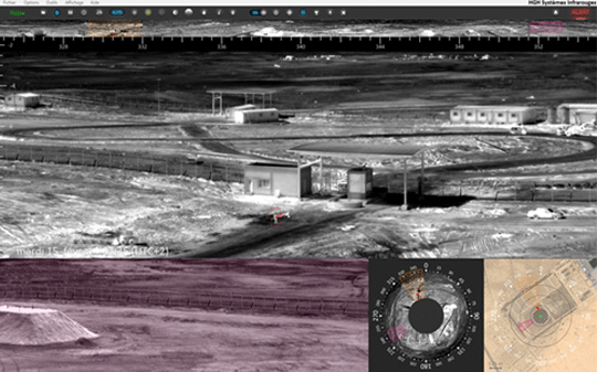
Cyclope interface
Detection & tracking
Aerial detection
Motion detection

Play back mode
Fusion with AIS signal
![]()
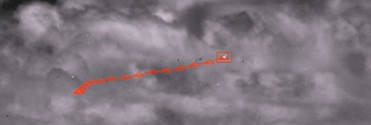
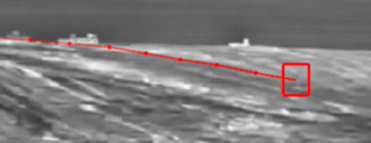
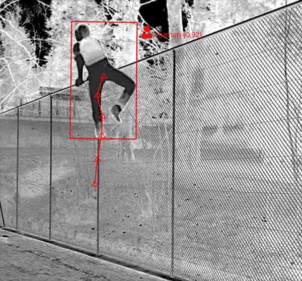
GAIA: automatic threats classification based on Artificial Intelligence
Integrated into the SPYNEL long-distance surveillance solutions, the newest GAIA Artificial Intelligence processing features unique capabilities in the market in terms of automatic classification of objects within panoramic thermal images. The AI module makes use of three patent-pending neuronal networks designed to recognize patterns for maritime, land and air surveillance applications. The automatic classification is operational at long-distance, on a very wide range of land and sea targets, from just a few pixels to very large objects.
The unique combination of GAIA Artificial Intelligence with Cyclope video analytics provides advanced detection, tracking and classification of any kind of threats. Whilst the use of Artificial Intelligence drastically lowers false alarm rate for wide area surveillance applications, it improves human decision efficiency and decreases the use of operational means.
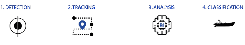
From detection to classification : the 4 steps of the GAIA process
Artificial Intelligence main benefits
- False alarm rate highly reduced
- Custom parameters easy and quick to set up
- Real-time information
- Improve reliability
- Facilitate human decision
- Reduces the human resources costs (security crews)
Gaïa key features
- First threat appearance detection and classification from (no latency)
- Support any kind of threat size: from few pixels to very large objects
- Any distance detection: short, medium and long range
- Stationnary and/or moving objects detection
- Alarm confirmations:
- Very fast moving objects
- Short range
- Discontinuous visibility due to obstacles (foliage, trees…)
- Very low false alarm rate in complex conditions:
- Moving vegetation,
- Animals,
- High sea state,
- Sun glints…
- Improved target range assessment
- Multiple classes available: human, vehicle, buoy, RIB, sailing ship…
- Ability to detect humans in any position and/or partially hidden objects
- Scalable customizable algorithm :
- New classes (required for a specific Customer application)
- Algorithm optimization
Alarm management Module
Automatic threats classification according to multiple conditions (GAIA classification, dimensions, trend, intensity, speed, trajectory, target class, size, virtual fence crossing, distance…)
Automatic Alarms to trigger specific actions (recording, email, XML, specific bookmark…)
GAIA Artificial Intelligence is boosted by the I2Q image processing library allowing to achieve superior day/night image quality whatever the environmental conditions. I2Q image processing includes multiple algorithms to improve user experience such as sun glint reduction, smart denoising, local contrast image enhancement and more.
I²QTM Library for smart image enhancement
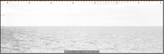
Original image
(satured zones within the panorama)
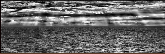
I²Q quality enhancement
(no saturation over 360°)
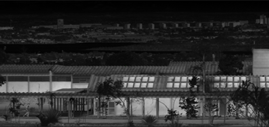
Original image
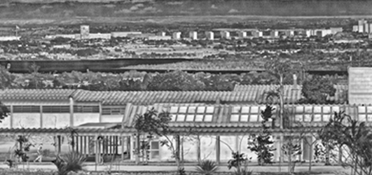
After I²Q terrestrial pre-processing
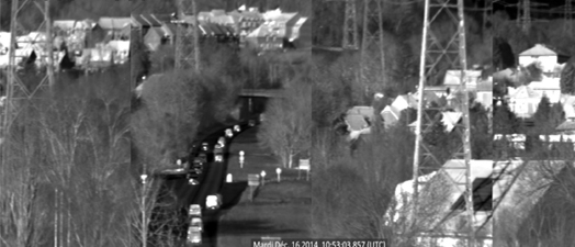
Original image
After I²Q distorsion correction
(Image stitching – distorsion correction)
