SPYNEL-UVISIBLE AND INFRARED PANORAMIC SURVEILLANCE CAMERA
SPYNEL-U is an uncooled, long-wave infrared (LWIR) camera solution embedding two panoramic videos (thermal and visible).
The integrated channels enable the detection, tracking, and identification of multiple threats in real-time, over a 360° environment. The SPYNEL-U camera ensures a precise situational awareness whatever the conditions may be: at night in total darkness, through bad weather… SPYNEL-U provides real-time thermal and visible high definition images (HD).
PRODUCT RANGE
SPYNEL-U 1000
Detection range
Human: up to 1 km
Vehicle: up to 2 km
RHIB: up to 2 km
Recognition range
Human: up to 350 m
Vehicle: up to 700 m
RHIB: up to 700 m
Horizontal field of view
360°
Vertical field of view
18° (-15° to +3°)
360° scanning speed
0.5 rps (360°/2sec)
Infrared image resolution
5M pixels
Visible image resolution
50M pixels
Infrared detector
Uncooled Long-Wave Infrared (LWIR)FPA
(≥600 pixels horizontally)
SPYNEL-U 2500
Detection range
Human: up to 2 km
Vehicle: up to 3.5 km
RHIB: up to 3.5 km
Recognition range
Human: up to 700 m
Vehicle: up to 1.4 km
RHIB: up to 1.4 km
Horizontal field of view
360°
Vertical field of view
9° (-6.5° to + 2.5°)
360° scanning speed
0.25 rps (360° / 4sec)
Infrared image resolution
10M pixels
Visible image resolution
100M pixels
Infrared detector
Uncooled Long-Wave Infrared (LWIR) FPA
(≥600 pixels horizontally)
360° visible and long-wave infrared detection performances
Human Recognition Range
Vehicle / RHIB Recognition Range
Human Detection Range
Vehicle / RHIB Detection Range
- *Up to
- Detection range according to Johnson criterium and STANAG standards.
- Range values represent optimal performance, which will vary depending on target size, clutter environment, atmospheric conditions and sensor operational settings
- Above information is subject to changes without notice
VISIBLE AND INFRARED SURVEILLANCE
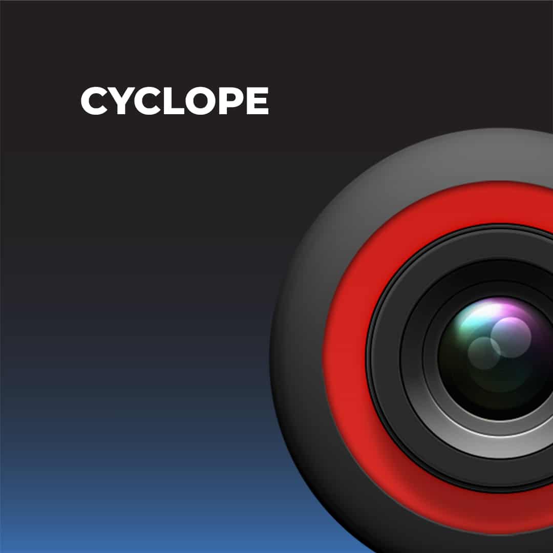
SPYNEL-U solution is highly appreciated for its visible and infrared (IR) capacities. The SPYNEL-U solution includes CYCLOPE, an exclusive software developped and constantly improved by HGH. The SPYNEL-U it detects multiple threats simultaneously, including small or moving ones like creeping people. Design for long-term and intensive use, Spynel-U does not require any cryogenic cooler and drastically limits maintenance operation. SPYNEL-U is recommended for infrastructure monitoring such as airports, harbour or power stations.
The 360° thermal camera improves the contrast allowing a high precision detection: optimized day and night image quality, multiple and simultaneous threats detection…
TECHNICAL SPECIFICATIONS
TECHNICAL SEPCIFICATIONS
SENSOR VISIBLE AND INFRARED DETECTORS
Uncooled long-Wave Infrared (LWIR) FPA – Visible: 2048 X 1536
IMAGE RESOLUTION
Visible: up to 100 M pixels – Infrared: up to 10 M pixels
PANORAMIC SURVEILLANCE
360 degrees rotation – Up to 0,5 rps (360°/2sec) scanning speed
INTEGRATION CAPABILITIES
ONVIF, H264, XML, MIME, TCP/IP, Client/Server
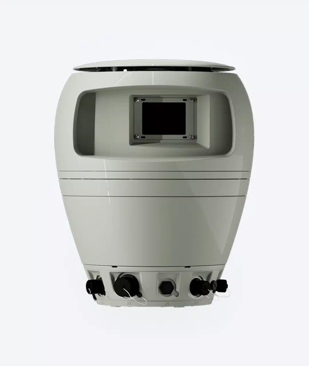
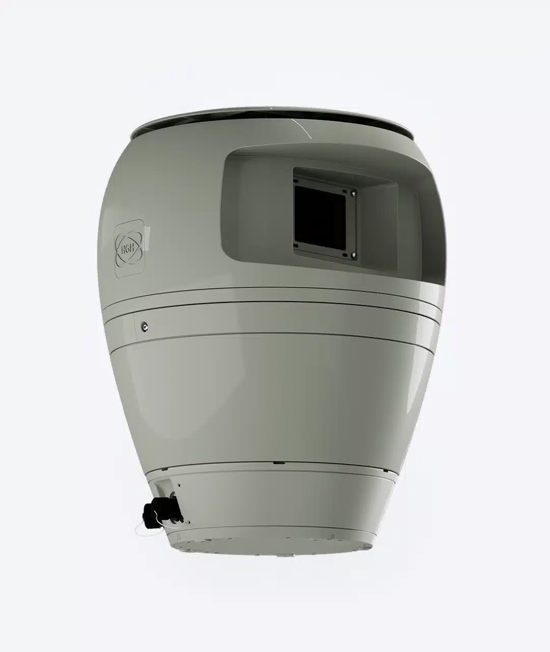
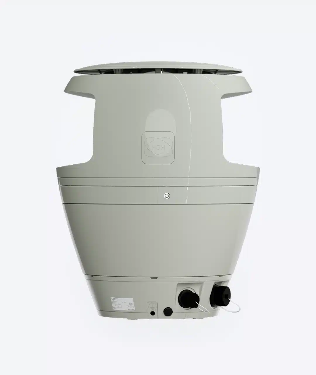
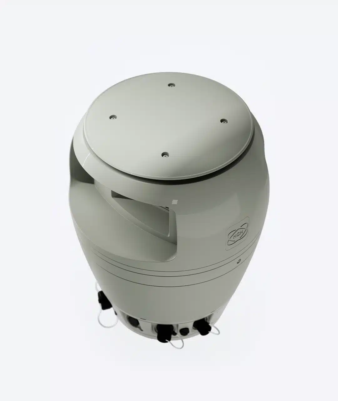
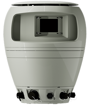
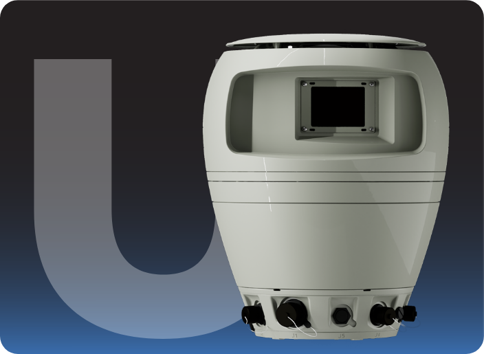
DIMENSIONS/WEIGHT
Weight: 25kg – Dimensions (Dia x H): 400 mm x 500 mm
VERTICAL SPECIFICATIONS
Vertical FOV: 9° to 18°
EXTREME CONDITIONS DESIGN
Fully waterproof
Spynel-U is a panoramic, long-range, wide area surveillance system designed to detect, classify and track automatically any type of threats.
Spynel-U provides precise situational awareness through a 360-degree view. Fully passive, SPYNEL-U allows visible and infrared imaging. It is the only wide area surveillance camera able to combine two different views within the SPYNEL range. SPYNEL-U is undetectable (passive) and also unjammable unlike the radar technology. Equipped with a uncooled Long-Wave Infrared (LWIR) detector, the Spynel-U® displays up to 10 M pixels for infrared image resolution, and up to 100 M pixels for the visible image resolution (SPYNEL-U 2500 series) .
Backed with HGH’s exclusive Cyclope advanced threat detection software, the 360° Infrared (IR) and visible camera allows early target discrimination at day and night, whatever the weather may be. An unlimited number of tracks are simultaneously detected and identified. No exception is made for hardly detectable threats like swimmers or RIBs.
SPYNEL-U® is a must-have solution for wide area surveillance: airport, airfield, harbour, offshore plateforms, oil rigs, refinerie, petrochemical sites, border and coastal surveillance, continuous perimeter security and critical infrastructure protection.
| SPYNEL-U 1000 | SPYNEL-U 2500 | |
|---|---|---|
| Horizontal FOV | 360° | 360° |
| Vertical FOV | 18° (-15° to 3°) | 9° (-6.5° to +2.5°) |
| Scanning speed | 0.5 rps (360° / 2sec) | 0.25 rps (360° / 4sec) |
| Infrared detector type | Uncooled LWIR FPA (≥ 600 pixels horizontally) | |
| Infrared image resolution | 5 Mpixels | 10 Mpixels |
| Visible detector type | 2048 x 1536 | |
| Visible image resolution | 50 Mpixels | 100 Mpixels |
| Video output and control | TCP/IP | |
| Dimensions (Diameter x Height) | 400 mm x 500 mm | |
| Weight | 25 kg | |
| Protection standard | IP 66 | |
| Power supply | 24V DC / 10 Amps at startup | |
| Detection range for Human: Vehicle: RHIB: | Up to 1 km Up to 2 km Up to 2 km | Up to 2 km Up to 3.5 km Up to 3.5 km |
Detection ranges according to Johnson criterium and STANAG standards
![]()
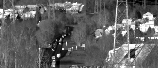
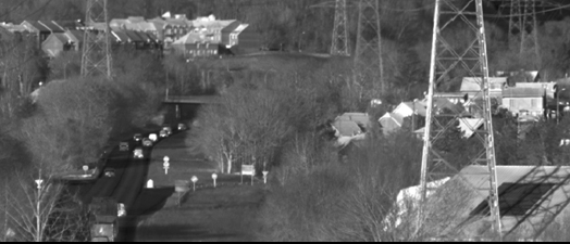
the 360-degree high resolution video stream captured by the SPYNEL camera.
> Download Cyclope brochure
> Cyclope video
Cyclope main benefits
- Signal processing based on 15 years experience for all applications
- One single core software to ensure reliability and robustness
- All-In-One Cyclope Server processing unit (Hardware and Software)
- Additional set of plugins
Cyclope main features
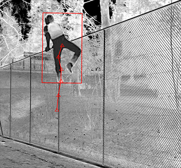
- Automatic detection & classification
- Automatic tracking
- All ground, air and maritime targets detected
- Manual or automatic detection parameters setup (no operator adjustment)
- 3D detection
- Custom zones definition
- Custom threats definition
- Crossing line detection function
- Alarm management editor
- New threats automatic visualisation and tracking
Specific algorithms
- AI depp learning algorithm for automatic threat classification
- Sky detection capabilities in cluttered environment
- Specific fire detection
- Long range tracking motion detection (any targets and thermal contrasts supported)
Alarm Editor, custom alarm definition by:
- Class
- Zone
- Dimension
- Trend
- Intensity
- Speed
- Direction
Specific actions automatic alarms:
- Recording
- XML
- Specific bookmark…
Analysis
- Intrusion bookmarks
- Manual
- Automatic
- Post-analysis
- Easy timeshift function (replay)
- 360° recording
- Geographic targets position detection
- Intrusion instantaneous mapping
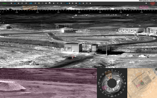
Cyclope interface
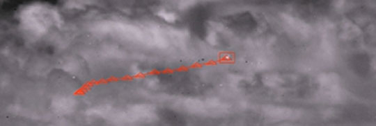
Detection & tracking
Sky detection
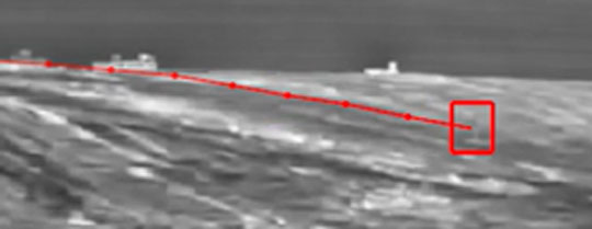
Motion detection
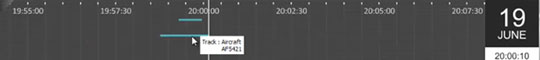
Bookmarks
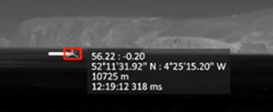
Geographic position
![]()
GAIA: automatic threats classification based on Artificial Intelligence
Integrated into the SPYNEL long-distance surveillance solutions, the newest GAIA Artificial Intelligence processing features unique capabilities in the market in terms of automatic classification of objects within panoramic thermal images. The AI module makes use of three patent-pending neuronal networks designed to recognize patterns for maritime, land and air surveillance applications. The automatic classification is operational at long-distance, on a very wide range of land and sea targets, from just a few pixels to very large objects.
The unique combination of GAIA Artificial Intelligence with Cyclope video analytics provides advanced detection, tracking and classification of any kind of threats. Whilst the use of Artificial Intelligence drastically lowers false alarm rate for wide area surveillance applications, it improves human decision efficiency and decreases the use of operational means.
From detection to classification : the 4 steps of the GAIA process

Artificial Intelligence main benefits
- False alarm rate highly reduced
- Custom parameters easy and quick to set up
- Real-time information
- Improve reliability
- Facilitate human decision
- Reduces the human resources costs (security crews)
Gaïa key features
- First threat appearance detection and classification from (no latency)
- Support any kind of threat size: from few pixels to very large objects
- Any distance detection: short, medium and long range
- Stationnary and/or moving objects detection
- Alarm confirmations:
- Very fast moving objects
- Short range
- Discontinuous visibility due to obstacles (foliage, trees…)
- Very low false alarm rate in complex conditions:
- Moving vegetation,
- Animals,
- High sea state,
- Sun glints…
- Improved target range assessment
- Multiple classes available: human, vehicle, buoy, RIB, sailing ship…
- Ability to detect humans in any position and/or partially hidden objects
- Scalable customizable algorithm :
- New classes (required for a specific Customer application)
- Algorithm optimization
Alarm management Module
Automatic threats classification according to multiple conditions (GAIA classification, dimensions, trend, intensity, speed, trajectory, target class, size, virtual fence crossing, distance…)
Automatic Alarms to trigger specific actions (recording, email, XML, specific bookmark…)
GAIA Artificial Intelligence is boosted by the I2Q image processing library allowing to achieve superior day/night image quality whatever the environmental conditions. I2Q image processing includes multiple algorithms to improve user experience such as sun glint reduction, smart denoising, local contrast image enhancement and more.
I²QTM Library for smart image enhancement
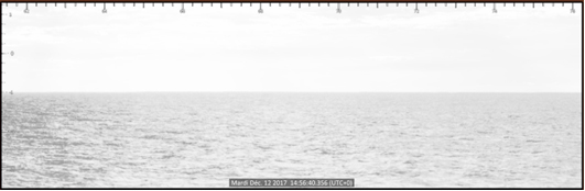
Original image
(satured zones within the panorama)
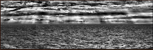
I²Q quality enhancement
(no saturation over 360°)
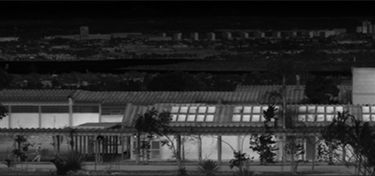
Original image
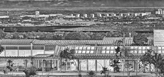
After I²Q terrestrial pre-processing
Original image
After I²Q distorsion correction
(Image stitching – distorsion correction)
Applications
Applications
DISCOVER ALSO